KAEK 2026: what it is, what its digits mean and how to find it in the Land Registry
by Housemaster on 5 October 2026
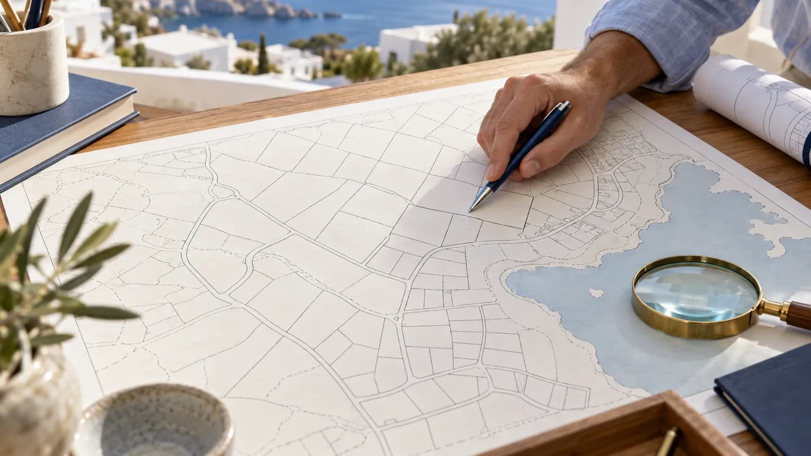
The KAEK (Cadastral Code Number) is the unique number the Land Registry (Cadastre) uses to identify every property. It works like the property's "tax number": every transfer, mortgage, inheritance or correction is recorded on the cadastral sheet that matches this code.
If you are buying, selling, inheriting or taking out a mortgage, you will almost certainly be asked for it. Below you will see what its digits mean, how to find it and what to do if your property has been recorded incorrectly.
At a glance
- What the KAEK is: a 12-digit code that uniquely identifies each land parcel. For apartments, a suffix in the form /0/1 is added.
- What the digits mean: 2 for the prefecture, 3 for the local authority (municipality or community), 2 for the cadastral sector, 2 for the cadastral unit (usually a city block) and 3 for the serial number of the land parcel.
- How to find it: free of charge, with your Taxisnet credentials, through the "My Land Registry" (To Ktimatologio mou) service on gov.gr or the online services of ktimatologio.gr. It also appears in your contract, in Land Registry documents and, if you have declared it, in column 27 of the E9.
- Key documents: Copy of the Cadastral Sheet (€9.50, +€4.50 per extra sheet) and Extract of the Cadastral Diagram (€15), by online application.
- Status in 2026: 99% of the country has posted cadastral data and KAEKs. The goal is to complete the cadastral survey by the end of 2026. 392 mortgage registries have closed and the Hellenic Cadastre has taken over their duties.
- Wrong entry: it can be corrected, but only within a deadline that varies by area. Once it expires, the entry becomes final and a property recorded as "unknown owner" is deemed to belong to the State.
What is the KAEK?
The KAEK is the Cadastral Code Number, the unique number given to every property when it is recorded in the Land Registry. It does not change when the owner changes.
Each property has its own cadastral sheet with its full legal picture: rights holders, shares, titles and encumbrances. The KAEK is the "key" to finding that sheet.
The old mortgage registries organised deeds by the owner's name; the Land Registry organises them by property, which is why almost every transaction starts from the KAEK.
What is the difference between the KAEK and the ATAK?
The KAEK belongs to the Land Registry. The ATAK (Property Identity Number) belongs to AADE and is used for tax purposes, mainly in the E9 and for ENFIA.
They are two different systems, so shares, type of right and square metres must match in both.
How does a provisional KAEK differ from a final one?
The KAEK is already assigned during the cadastral survey, when the data for an area is posted. At this stage it is provisional and may change if the boundaries or the property details are corrected.
It becomes final when the cadastral survey is completed and the first entries are recorded in the cadastral books. AADE accepts either a provisional or a final KAEK in the E9.
KAEK: what do the 12 digits mean?
The 12 digits of the KAEK show the geographical location of the land parcel, from the prefecture down to the number of the specific plot or field. The breakdown is as follows:

| Digit position | Count | What it shows |
|---|---|---|
| 1–2 | 2 | Prefecture, using the old division into prefectures and alphabetical numbering (e.g. 05 = Attica, 19 = Thessaloniki) |
| 3–5 | 3 | Local authority, meaning municipality or community, based on the older administrative division and not today's municipalities |
| 6–7 | 2 | Cadastral sector (e.g. a neighbourhood) |
| 8–9 | 2 | Cadastral unit (in cities usually a city block) |
| 10–12 | 3 | Serial number of the land parcel within the unit |
What does the suffix /0/0, /0/1 or /1/0 mean?
The suffix shows whether we are talking about the whole land parcel or a separate property within it.
- The number after the first slash shows the vertical property, if one has been established (for example, when there are two independent buildings on the same plot).
- The number after the second slash shows the horizontal property, meaning the apartment, shop or parking space.
- /0/0 generally corresponds to the land parcel as a whole, with no vertical or horizontal property.
So apartments in the same building share the same first 12 digits and differ only in the suffix. In the Land Registry's online applications the code is requested in the "extended" 16-digit form, which also includes the vertical and horizontal property numbers.
Example of reading a KAEK
Take the hypothetical KAEK 05 101 23 07 015 /0/3:
- 05: prefecture of Attica
- 101: the local authority (municipality or community) of the area
- 23: the cadastral sector
- 07: the cadastral unit, e.g. the city block
- 015: the 15th land parcel in the unit
- /0/3: the third horizontal property (e.g. an apartment), with no vertical property
Be careful: with the wrong suffix you will get a document for a different apartment, and the application cannot be cancelled or changed once submitted.
How do I find my property's KAEK?
The quickest way is online, with your Taxisnet credentials, free of charge. If you do not have access, the KAEK also appears on documents you probably already have.
| Where to find it | What you need | Note |
|---|---|---|
| "My Land Registry" (gov.gr) | Taxisnet credentials | Free. Shows the properties under your tax number, the KAEK, the type of right and the location on a map |
| ktimatologio.gr online services | Taxisnet credentials | For areas with an operating Land Registry, provided the property is linked to your tax number |
| Digital Map (maps.ktimatologio.gr) | Nothing | Search by address or KAEK. Shows boundaries and KAEK, not owners' names |
| Purchase contract or acceptance of inheritance | - | In areas with a Land Registry it appears in the property description |
| Cadastral sheet, diagram extract, certificates | - | The KAEK appears at the top of the document |
| E9 (column 27) | - | Only if you or your accountant have already filled it in |
Steps in the "My Land Registry" service
- Go to the service page on gov.gr and log in with your Taxisnet credentials.
- You see the properties registered under your tax number, with address, area and KAEK.
- Check the location on the map and the type of right (full ownership, bare ownership or usufruct).
- Compare the details with your E9.
What do I do if the property does not appear?
This does not mean you are not the owner. Usually the area does not yet have an operating Land Registry, or your tax number is missing or wrong in the entry. Find the KAEK on the Digital Map and request a copy of the cadastral sheet to see what has been recorded.
Is the KAEK on the electricity bill?
No. The electricity bill shows the supply number, which has nothing to do with the KAEK; do not confuse the two numbers in applications and forms.
Where is the KAEK needed?
The KAEK is needed for every deed that concerns the property and is registered in the Land Registry, as well as in certain tax and planning documents.
| Case | Why it is needed |
|---|---|
| Sale, parental gift (goniki paroxi), donation | The notary describes the property with the KAEK and attaches an Extract of the Cadastral Diagram to the registration application |
| Acceptance of inheritance | The deed is registered on the property's cadastral sheet |
| Mortgage loan | The bank checks the cadastral sheet and registers the pre-notation or the mortgage on the same sheet |
| E9 | Column 27: "KAEK/Property code", provisional or final |
| Electronic Building Identity Card | The law requires specific reference to the KAEK of the plot or the divided property, where one exists |
If you are buying, ask the seller for the KAEK from the start, so you can check before paying a deposit that the property in the listing is the one recorded in the Land Registry. If you are still searching, you can start from the homes for sale on the map and ask for the KAEK of the ones you are seriously interested in.
Cadastral sheet and diagram extract: what are they and how much do they cost?
The Copy of the Cadastral Sheet shows the legal status of the property. The Extract of the Cadastral Diagram shows the location and boundaries of the property on the map, together with the KAEK.
| Document | What it contains | Fee | Where to request it |
|---|---|---|---|
| Copy of the Cadastral Sheet (KF) | Location, rights holders and shares, titles, encumbrances (mortgages, pre-notations, seizures), registered lawsuits | €9.50 (+€4.50 for each extra sheet) | gov.gr or myKTIMATOLOGIOlive, with Taxisnet, or at the Cadastral Office |
| Extract of the Cadastral Diagram (AKD) | The property on the map, within the wider area, with its KAEK | €15 | As above |
| Certificate of Property Under Cadastral Survey (PKA) | Confirms that the property has been declared, in areas still under cadastral survey | Small fixed fee | Online, with Taxisnet |
According to the National Register of Administrative Procedures "Mitos" (updated 25.9.2026), the estimated time for the online issue of the KF and AKD is about 6 days. Payment is by card or web banking.
What should you check on the cadastral sheet before you buy?
- whether the seller is actually the registered rights holder and with what share,
- whether the right is full ownership or only bare ownership or usufruct,
- whether there are mortgages, pre-notations or seizures,
- whether there is a registered lawsuit disputing ownership,
- whether the area and description match the titles and reality,
- and whether the first entry is still "open" to correction, meaning whether the deadline for the area has not yet expired.
The cadastral sheet is the starting point, not the whole check. A complete legal check of the property also examines previous titles, the continuity of ownership and pending issues that are not always visible at first glance.
How much does registration in the Land Registry cost?
Registration fees are set by Joint Ministerial Decision 2/12.01.2026 (Government Gazette (FEK) B 64/13.01.2026). They are calculated as a percentage of the value of the deed, plus fixed amounts.
| Deed | In transcription/mortgage books | In cadastral book (operating Land Registry) | Fixed amounts |
|---|---|---|---|
| Sale | 5‰ | 6‰ | €3 + €20 |
| Donation, parental gift, mortgage, pre-notation | 8‰ | 9‰ | €12 + €20 |
Worked example
You buy an apartment for €200,000 in an area with an operating Land Registry and take out a mortgage loan, for which the bank registers a pre-notation of €150,000.
- Registration of the sale: 200,000 × 6‰ = €1,200 + €3 + €20 = €1,223
- Registration of the pre-notation: 150,000 × 9‰ = €1,350 + €12 + €20 = €1,382
The other costs (transfer tax, notary, lawyer) are broken down in our guide to the costs of buying a property.
What are first entries and how are they corrected?
First entries are those recorded when the cadastral survey of an area was completed. If they are wrong, they can only be corrected within a specific deadline; after that they become final.
Common errors are a wrong share, the property recorded under someone else's name, a forgotten storage room or parking space, and wrong boundaries.
Which procedure do you follow depending on the error?
| Type of error | Procedure |
|---|---|
| Obvious error (e.g. a wrong detail that clearly follows from the documents) | Correction application, without going to court |
| Geometric data (boundaries, area) due to an obvious error | Online application on the metavoles platform, usually through an engineer |
| Wrong rights holder or wrong right | Lawsuit against the registered rights holder, with a mandatory initial mediation session |
| "Unknown owner" property | Application before the Cadastral Judge or lawsuit against the Greek State; for adverse possession (extraordinary usucapion) a special mediation procedure applies |
The metavoles platform has been operating since 18 September 2026, under decision 440/9 of the Board of the Hellenic Cadastre (Government Gazette (FEK) B 5454/08.09.2026). The application is submitted with Taxisnet credentials, and neighbouring owners are notified and can file objections.
What is the correction deadline?
There is no single date for the whole country. It depends on when the cadastral survey was declared and when the Land Registry started operating in each area.
- General rule: the deadline expires on 31 December of the year in which eight years have passed since the Land Registry came into force in the area.
- Older areas: where the deadline was due to expire on 30.11.2024, Law 5160/2024 extended it. It now expires one year after publication of an act of the Board of the Hellenic Cadastre confirming that the Land Registry has replaced the transcription and mortgage system across the whole country. Based on the available information, this act had not been issued by early October 2026.
The Land Registry publishes on ktimatologio.gr a file with the deadlines by prefecture and local authority (the relevant page was updated on 7.10.2026). This is the first thing you should check for your own area.
What happens when the deadline expires?
First entries that were not challenged in time become final and create an irrebuttable presumption in favour of the person recorded as rights holder. The real owner can no longer request a change to the entry; as a rule, all that remains is a monetary claim against the registered rights holder.
What happens if the property was not declared to the Land Registry?
If you did not declare the property during the cadastral survey, it has most likely been recorded as "unknown owner" or, in some cases, under someone else's name. While the correction deadline is open, you can request to be recorded. Once it expires, the "unknown owner" property is deemed to belong to the Greek State.

What you can do depends on the stage your area is at:
- During posting: under Law 5142/2024, the deadline for a correction application is two months from the start of posting, both for those living in Greece and for those living abroad. The application is submitted online on ktimatologio.gr or by appointment at the competent office.
- After the first entries: application to the Cadastral Judge or lawsuit against the State, always before the area's deadline expires.
- If you rely on adverse possession (extraordinary usucapion): since 16.9.2026 a new procedure with a cadastral mediator applies (article 61 of Law 5326/2026, Government Gazette (FEK) A 125/4.8.2026).
What does the new mediation procedure provide?
It concerns "unknown owner" properties that someone has possessed as owner for at least 20 years. The interested party first registers a basic data sheet in the Land Registry, with a fixed fee. The invitation to the mandatory initial session, before a mediator from a special register, is sent at least 30 days after its registration.
Required evidence includes, among other things, at least two sworn statements on the 20-year possession, an E9 in which the property was declared at least 10 years before the mediation, and at least two more documents, such as utility bills in your name or lease agreements.
The State takes part in the mediation. If it does not assert any rights, it can declare that it does not object to the correction. Acquisition by adverse possession is taxed like a transfer, and the relevant declaration is filed with AADE before registration. Public estates and common-use property are excluded.
Where does the cadastral survey stand in 2026?
According to announcements by the Ministry of Digital Governance (May–July 2026), 99% of the country has posted cadastral data and KAEKs. The goal is to complete the cadastral survey by the end of 2026; most of the roughly 200,000 pending cases are expected to be resolved during 2027.
Posting does not mean an operating Land Registry. For example, in the municipalities of Kallithea and Palaio Faliro the Land Registry only came into force on 7 October 2026 (decision PR 1172/2645201, Government Gazette (FEK) B 6049/07.10.2026). The Digital Map shows which stage each area is at.
Are there still mortgage registries?
Not as separate services. According to the Ministry of Digital Governance (January 2025), 392 mortgage registries closed permanently, 201 of them during 2024, and the Hellenic Cadastre took over their duties.
Since 30 September 2024, deeds and applications at all Cadastral Offices and Branches are submitted only digitally. In areas where the Land Registry is not yet operating, deeds are still registered in the transcription and mortgage books, but now by the Cadastral Offices.
What should you check about the KAEK and the Land Registry?
Whether you already own a property or plan to buy, confirm:
- that each of your properties appears in "My Land Registry" with the correct KAEK,
- that ancillary spaces (storage room, parking space) have their own KAEK or are correctly recorded as appurtenances,
- that share, type of right, boundaries and area match the titles, the E9 and reality,
- that there is no "unknown owner" record on a property that belongs to you,
- and what the correction deadline is for your area in the ktimatologio.gr file.
If you plan to buy, the full legal and technical check package combines the Land Registry and title check with a check of the property's planning compliance.
Frequently asked questions
Is the KAEK the same for the whole apartment building?
The first 12 digits are shared by all apartments, because they refer to the plot. Each apartment, shop or parking space that is a separate property is distinguished by its suffix, e.g. /0/1, /0/2.
Can I find the KAEK without Taxisnet credentials?
Yes. On the Land Registry's Digital Map (maps.ktimatologio.gr) you search by address and see the KAEK of the land parcel. You will find the KAEK of the specific apartment in the contract or in Land Registry documents.
Can I see who owns a property from the KAEK?
The Digital Map does not show owners' names. The copy of the cadastral sheet shows the rights holders and is issued online or by the Cadastral Office, following the prescribed procedure.
How much does it cost to find my KAEK?
Nothing. Searching in "My Land Registry" and on the Digital Map is free. You only pay if you request an official document, such as a copy of the cadastral sheet (€9.50) or a diagram extract (€15).
Does the KAEK change when I sell the property?
No. The KAEK follows the property, not the owner. As a rule, it only changes if the property itself changes, for example through subdivision, merging of plots or creation of new divided properties.
Is it mandatory to enter the KAEK in the E9?
The E9 form has a specific column (27) for the KAEK, provisional or final. Filling it in helps match AADE's data with the Land Registry's and avoid discrepancies in a future transfer.
What happens if the area in the Land Registry is smaller than in the titles?
If the difference is due to an obvious error, the geometric data is now corrected online through the metavoles platform, usually with an engineer's topographic survey. If there is a dispute with a neighbour, court action may be needed.
Can I sell a property recorded as "unknown owner"?
No, as long as the entry has not been corrected. A transfer is registered in the Land Registry only if the seller appears as rights holder on the cadastral sheet. First the entry must be corrected in your name.
Is an inheritance registered automatically in the Land Registry?
No. The heirs must make an acceptance of inheritance and register it on the cadastral sheet. Until then the property appears in the name of the deceased and cannot be transferred or mortgaged by the heirs.
Who do I contact with questions about the KAEK or my entries?
You can call the Hellenic Cadastre's customer service centre (210 6505600) or book an appointment at your area's Cadastral Office. For some services, remote support is also available through the myKTIMATOLOGIOlive platform.
In the end, why should you care about your property's KAEK?
Because what the Land Registry says is what counts. In a sale, an inheritance or a loan, the notary and the bank look at the cadastral sheet.
An error that can be fixed today with an application may, once the deadline expires, not be fixable at all. The check takes a few minutes: find the KAEK with Taxisnet, request the cadastral sheet and compare it with your titles and the E9.
If you find a discrepancy, do not leave it for later.
Sources and updates
This article is based on the current framework for the National Land Registry (Law 2664/1998 and Law 2308/1995, as in force, Law 4623/2019, Law 5142/2024, Law 5160/2024, Law 5326/2026), Joint Ministerial Decision 2/12.01.2026 on fees (Government Gazette (FEK) B 64/13.01.2026), decision 440/9 of the Board of the Hellenic Cadastre (Government Gazette (FEK) B 5454/08.09.2026), decision PR 1172/2645201 (Government Gazette (FEK) B 6049/07.10.2026) and the Spatial Planning and Urban Planning Code (Law 5306/2026), as well as information from the Hellenic Cadastre (ktimatologio.gr), the National Register of Administrative Procedures (mitos.gov.gr), the Ministry of Digital Governance, gov.gr and AADE (E9 instructions).
The content is for information only and does not replace personalised legal or technical advice. Correction deadlines vary by area and the framework changes often. Before a sale, an entry correction or legal action, confirm what applies in your own case with a lawyer or engineer.